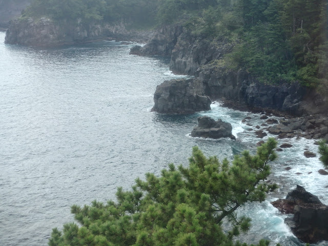
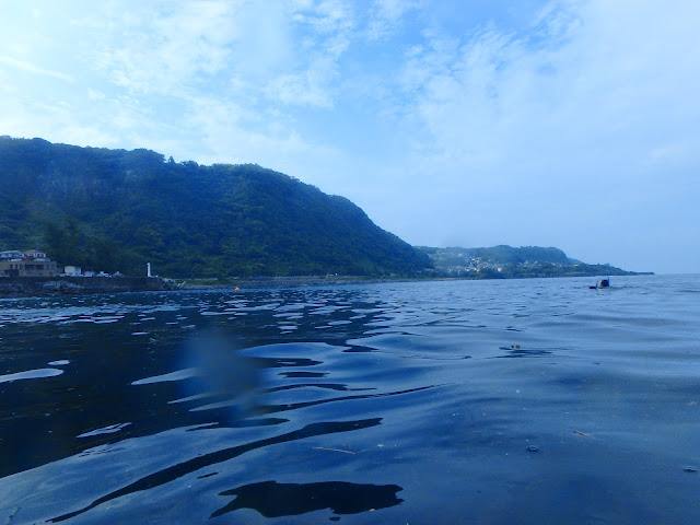
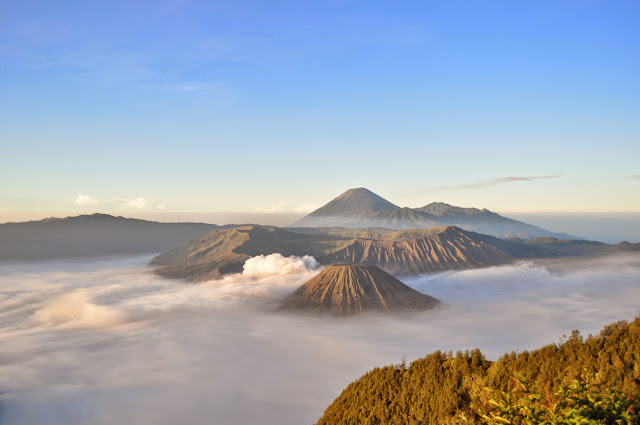
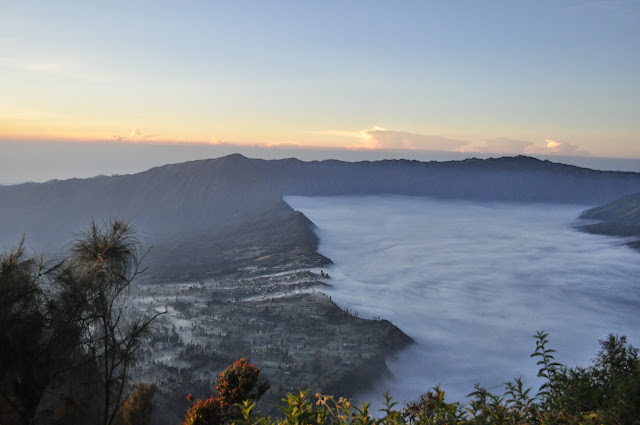
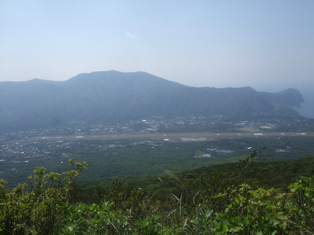
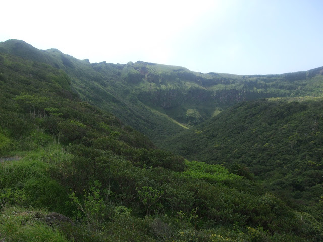
A long overdue photo post from last Autumn.
Finally got around to walking the Oze mashlands trail. Had always wanted to do this, since living in Fukushima back on my JET days.
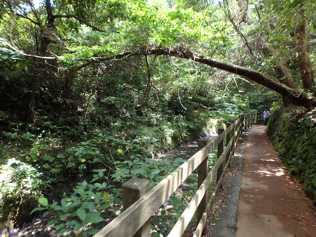
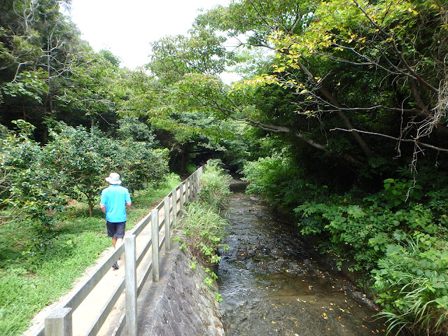
It’s a nice easy leisurely walk on wooden platforms around the Oze national park marshlands (when you’re lucky enough to not be led around by the group guide at a whip-cracking pace).
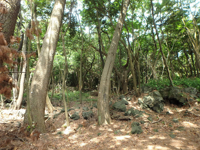
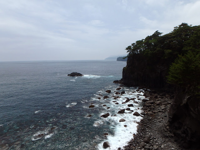
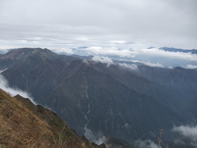
Am getting lazy with the writing, so enjoy the photo overload.
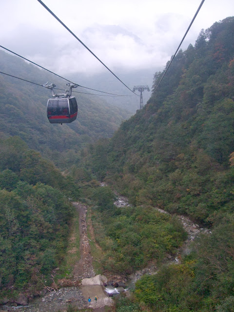
<table style=”width:auto”><tr><td><a href=”https://picasaweb.google.com/lh/photo/yRxzmjovD6V__GXeNTbJRQOVP5pgN1J-7jWX7d-iNUU?feat=embedwebsite”><img src=”https://lh3.googleusercontent.com/-IkCwGX_Od2s/UoddEem6sdI/AAAAAAACZWA/wzM-uZirRGQ/s640/DSC_0326.JPG” height=”425″ width=”640″ /></a></td></tr><tr><td style=”font-family:arial,sans-serif;font-size:11px;text-align:right”>From <a href=”https://picasaweb.google.com/116032719585350311356/OzeTrail?authuser=0&feat=embedwebsite”>Oze trail</a></td></tr></table>
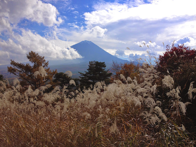
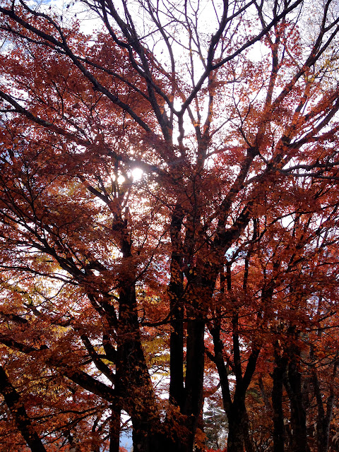
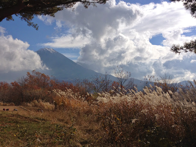
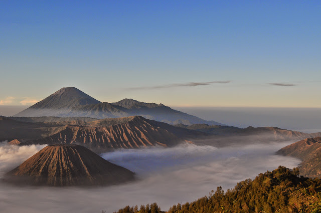
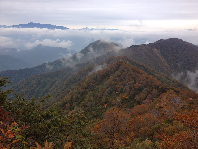
Autumn leaves:
<table style=”width:auto”><tr><td><a href=”https://picasaweb.google.com/lh/photo/pKTsgH8pEsaJ8aYobSR6kgOVP5pgN1J-7jWX7d-iNUU?feat=embedwebsite”><img src=”https://lh3.googleusercontent.com/-ZB-lAwqWlC4/UoddFnW1qgI/AAAAAAACZWQ/l1tCS2DSqtA/s640/DSC_0333.JPG” height=”425″ width=”640″ /></a></td></tr><tr><td style=”font-family:arial,sans-serif;font-size:11px;text-align:right”>From <a href=”https://picasaweb.google.com/116032719585350311356/OzeTrail?authuser=0&feat=embedwebsite”>Oze trail</a></td></tr></table>
<table style=”width:auto”><tr><td><a href=”https://picasaweb.google.com/lh/photo/a5NNfK2RUKnEqIiQv82WvwOVP5pgN1J-7jWX7d-iNUU?feat=embedwebsite”><img src=”https://lh5.googleusercontent.com/-DIDgbgPak7Y/UoddIFJpJ-I/AAAAAAACZXM/cBw4b1YvVlM/s640/DSC_0346.JPG” height=”425″ width=”640″ /></a></td></tr><tr><td style=”font-family:arial,sans-serif;font-size:11px;text-align:right”>From <a href=”https://picasaweb.google.com/116032719585350311356/OzeTrail?authuser=0&feat=embedwebsite”>Oze trail</a></td></tr></table>
<table style=”width:auto”><tr><td><a href=”https://picasaweb.google.com/lh/photo/_jzLDKa6kZ-nD44IOJnM9wOVP5pgN1J-7jWX7d-iNUU?feat=embedwebsite”><img src=”https://lh5.googleusercontent.com/-PE0pw31Ev2U/UoddJlAHGkI/AAAAAAACZXY/pr7gfqm6eFc/s640/DSC_0353.JPG” height=”425″ width=”640″ /></a></td></tr><tr><td style=”font-family:arial,sans-serif;font-size:11px;text-align:right”>From <a href=”https://picasaweb.google.com/116032719585350311356/OzeTrail?authuser=0&feat=embedwebsite”>Oze trail</a></td></tr></table>
<table style=”width:auto”><tr><td><a href=”https://picasaweb.google.com/lh/photo/T9jHjpmXyQTL2JJoPZd-yQOVP5pgN1J-7jWX7d-iNUU?feat=embedwebsite”><img src=”https://lh6.googleusercontent.com/-1LhJR_o2TPc/UoddL1sHuCI/AAAAAAACZX8/FR2i2wWGZmM/s640/DSC_0357.JPG” height=”425″ width=”640″ /></a></td></tr><tr><td style=”font-family:arial,sans-serif;font-size:11px;text-align:right”>From <a href=”https://picasaweb.google.com/116032719585350311356/OzeTrail?authuser=0&feat=embedwebsite”>Oze trail</a></td></tr></table>
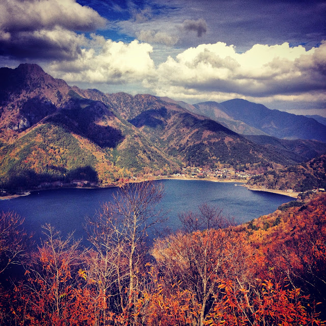
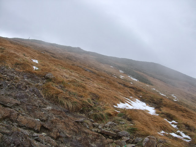
Hues of brown:
<table style=”width:auto”><tr><td><a href=”https://picasaweb.google.com/lh/photo/lV25oVgJjtWJTuDCkd1yMQOVP5pgN1J-7jWX7d-iNUU?feat=embedwebsite”><img src=”https://lh4.googleusercontent.com/-ueRixEazEPI/UoddMi9aLfI/AAAAAAACZYU/FDIq1wDnMcw/s640/DSC_0360.JPG” height=”425″ width=”640″ /></a></td></tr><tr><td style=”font-family:arial,sans-serif;font-size:11px;text-align:right”>From <a href=”https://picasaweb.google.com/116032719585350311356/OzeTrail?authuser=0&feat=embedwebsite”>Oze trail</a></td></tr></table>
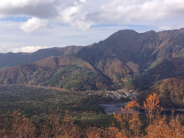
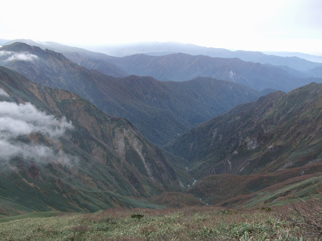
And more photos. Keep scrolling!
<table style=”width:auto”><tr><td><a href=”https://picasaweb.google.com/lh/photo/7u0NtuqMmJnz37iyGHvXlQOVP5pgN1J-7jWX7d-iNUU?feat=embedwebsite”><img src=”https://lh4.googleusercontent.com/-szdkptCoOpI/UoddN15ZXZI/AAAAAAACZYs/UcF4hQtsH68/s640/DSC_0362.JPG” height=”425″ width=”640″ /></a></td></tr><tr><td style=”font-family:arial,sans-serif;font-size:11px;text-align:right”>From <a href=”https://picasaweb.google.com/116032719585350311356/OzeTrail?authuser=0&feat=embedwebsite”>Oze trail</a></td></tr></table>
<table style=”width:auto”><tr><td><a href=”https://picasaweb.google.com/lh/photo/WKe72bmuBSZiQzmYujiUqAOVP5pgN1J-7jWX7d-iNUU?feat=embedwebsite”><img src=”https://lh3.googleusercontent.com/-ovOmXq8MwD0/UoddOFQ74XI/AAAAAAACZY4/FwCAliJ5-mQ/s640/DSC_0364.JPG” height=”425″ width=”640″ /></a></td></tr><tr><td style=”font-family:arial,sans-serif;font-size:11px;text-align:right”>From <a href=”https://picasaweb.google.com/116032719585350311356/OzeTrail?authuser=0&feat=embedwebsite”>Oze trail</a></td></tr></table>
<table style=”width:auto”><tr><td><a href=”https://picasaweb.google.com/lh/photo/tCHG-R4QeKh2m75WienYxwOVP5pgN1J-7jWX7d-iNUU?feat=embedwebsite”><img src=”https://lh5.googleusercontent.com/-bz548KcC4LY/UoddPMJ1hXI/AAAAAAACZZE/mr814lS-ITs/s640/DSC_0368.JPG” height=”425″ width=”640″ /></a></td></tr><tr><td style=”font-family:arial,sans-serif;font-size:11px;text-align:right”>From <a href=”https://picasaweb.google.com/116032719585350311356/OzeTrail?authuser=0&feat=embedwebsite”>Oze trail</a></td></tr></table>
<table style=”width:auto”><tr><td><a href=”https://picasaweb.google.com/lh/photo/vlOSbfZYsdoXkkMEEM5-pQOVP5pgN1J-7jWX7d-iNUU?feat=embedwebsite”><img src=”https://lh5.googleusercontent.com/-EVv0nuceEwE/UoddPh7n43I/AAAAAAACZZI/yCHCKxd7Nms/s640/DSC_0369.JPG” height=”425″ width=”640″ /></a></td></tr><tr><td style=”font-family:arial,sans-serif;font-size:11px;text-align:right”>From <a href=”https://picasaweb.google.com/116032719585350311356/OzeTrail?authuser=0&feat=embedwebsite”>Oze trail</a></td></tr></table>
<table style=”width:auto”><tr><td><a href=”https://picasaweb.google.com/lh/photo/vDvSwM2nT_yx6uvB8Rz5YwOVP5pgN1J-7jWX7d-iNUU?feat=embedwebsite”><img src=”https://lh6.googleusercontent.com/-r2zkrG_kjS0/UoddRrGY3pI/AAAAAAACZZw/R_b5WUCv67o/s640/DSC_0372.JPG” height=”425″ width=”640″ /></a></td></tr><tr><td style=”font-family:arial,sans-serif;font-size:11px;text-align:right”>From <a href=”https://picasaweb.google.com/116032719585350311356/OzeTrail?authuser=0&feat=embedwebsite”>Oze trail</a></td></tr></table>
<table style=”width:auto”><tr><td><a href=”https://picasaweb.google.com/lh/photo/807Qm5oEwFdfMZzxLZU8mwOVP5pgN1J-7jWX7d-iNUU?feat=embedwebsite”><img src=”https://lh3.googleusercontent.com/-VYXQNlOf1oM/UoddQ0hkGMI/AAAAAAACZZg/Rv_yWKlr_vA/s640/DSC_0373.JPG” height=”425″ width=”640″ /></a></td></tr><tr><td style=”font-family:arial,sans-serif;font-size:11px;text-align:right”>From <a href=”https://picasaweb.google.com/116032719585350311356/OzeTrail?authuser=0&feat=embedwebsite”>Oze trail</a></td></tr></table>
<table style=”width:auto”><tr><td><a href=”https://picasaweb.google.com/lh/photo/M532lsj7q4Yp9rRyEKXulwOVP5pgN1J-7jWX7d-iNUU?feat=embedwebsite”><img src=”https://lh5.googleusercontent.com/-z-OVlV26FXY/UoddSBwhThI/AAAAAAACZZ0/Q9bU8eyh_ow/s640/DSC_0375.JPG” height=”425″ width=”640″ /></a></td></tr><tr><td style=”font-family:arial,sans-serif;font-size:11px;text-align:right”>From <a href=”https://picasaweb.google.com/116032719585350311356/OzeTrail?authuser=0&feat=embedwebsite”>Oze trail</a></td></tr></table>
<table style=”width:auto”><tr><td><a href=”https://picasaweb.google.com/lh/photo/35UmgCIR07TBvDP62nfjVAOVP5pgN1J-7jWX7d-iNUU?feat=embedwebsite”><img src=”https://lh4.googleusercontent.com/-nrgfoy6YmAI/UoddSr4-kaI/AAAAAAACZaA/36Xmd4-BICg/s640/DSC_0376.JPG” height=”425″ width=”640″ /></a></td></tr><tr><td style=”font-family:arial,sans-serif;font-size:11px;text-align:right”>From <a href=”https://picasaweb.google.com/116032719585350311356/OzeTrail?authuser=0&feat=embedwebsite”>Oze trail</a></td></tr></table>
<table style=”width:auto”><tr><td><a href=”https://picasaweb.google.com/lh/photo/MKLKf-Z60AYIBfKfluEidAOVP5pgN1J-7jWX7d-iNUU?feat=embedwebsite”><img src=”https://lh6.googleusercontent.com/-s0A7ABT7yxQ/UoddTQ6B4JI/AAAAAAACZaY/Inq47cjphYY/s640/DSC_0379.JPG” height=”425″ width=”640″ /></a></td></tr><tr><td style=”font-family:arial,sans-serif;font-size:11px;text-align:right”>From <a href=”https://picasaweb.google.com/116032719585350311356/OzeTrail?authuser=0&feat=embedwebsite”>Oze trail</a></td></tr></table>
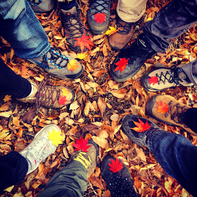
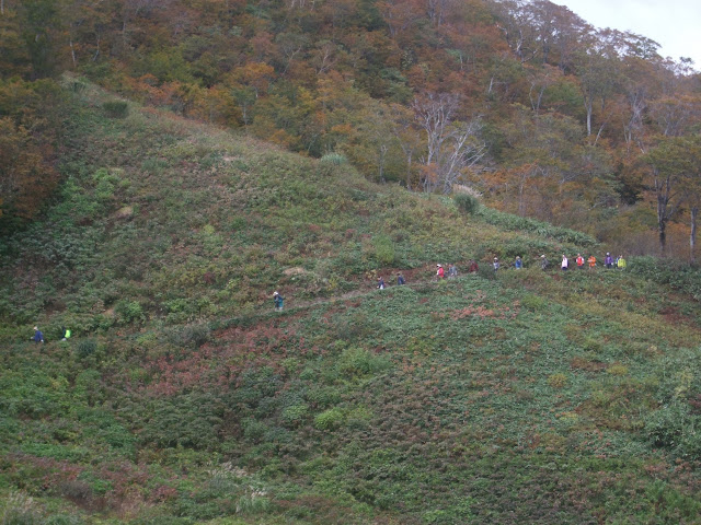
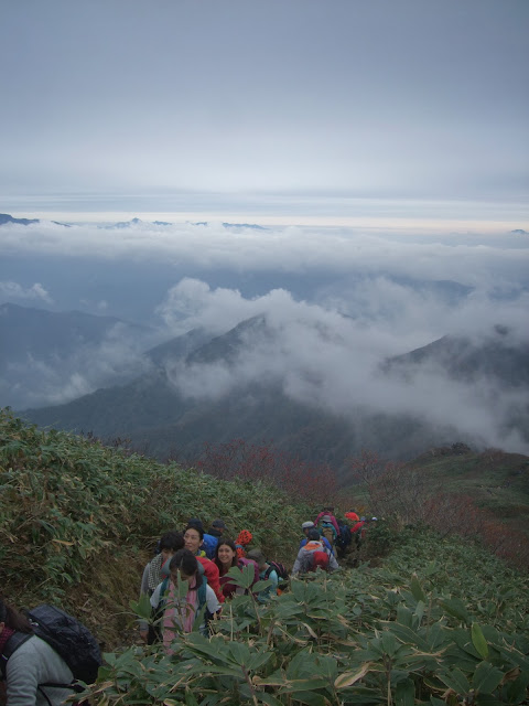
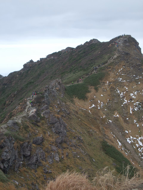
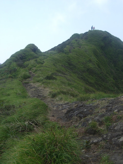
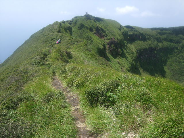
Playing follow the leader:
<table style=”width:auto”><tr><td><a href=”https://picasaweb.google.com/lh/photo/nr_IO9tKGwVExDLFuR2bfwOVP5pgN1J-7jWX7d-iNUU?feat=embedwebsite”><img src=”https://lh3.googleusercontent.com/-Os05Xa702Jw/UoddUV_yxwI/AAAAAAACZak/blo8z1-1WKI/s640/DSC_0381.JPG” height=”425″ width=”640″ /></a></td></tr><tr><td style=”font-family:arial,sans-serif;font-size:11px;text-align:right”>From <a href=”https://picasaweb.google.com/116032719585350311356/OzeTrail?authuser=0&feat=embedwebsite”>Oze trail</a></td></tr></table>
<table style=”width:auto”><tr><td><a href=”https://picasaweb.google.com/lh/photo/iMM3Wm8uQv-0jiVNvFy4TAOVP5pgN1J-7jWX7d-iNUU?feat=embedwebsite”><img src=”https://lh4.googleusercontent.com/-q727O_428qE/UoddUlj6ajI/AAAAAAACZa4/1CPGupYAsbU/s640/DSC_0383.JPG” height=”425″ width=”640″ /></a></td></tr><tr><td style=”font-family:arial,sans-serif;font-size:11px;text-align:right”>From <a href=”https://picasaweb.google.com/116032719585350311356/OzeTrail?authuser=0&feat=embedwebsite”>Oze trail</a></td></tr></table>
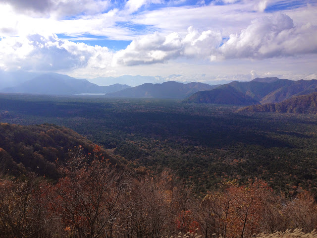
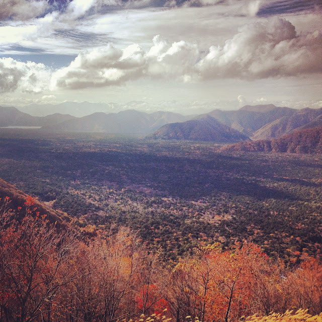
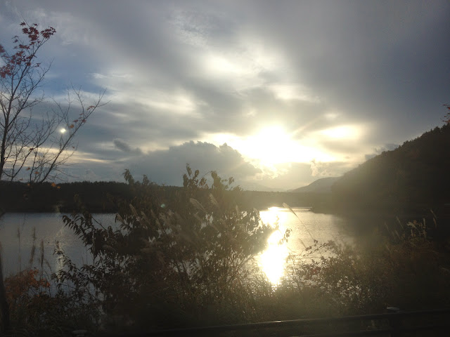
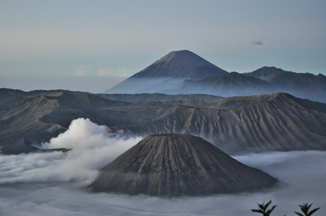
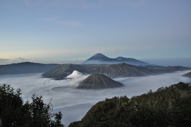
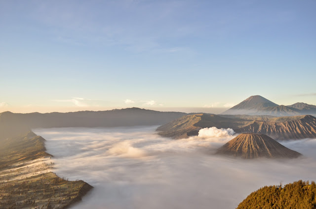
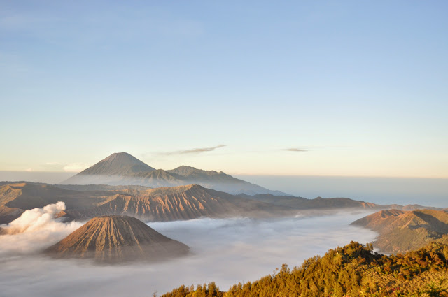
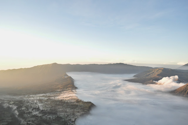
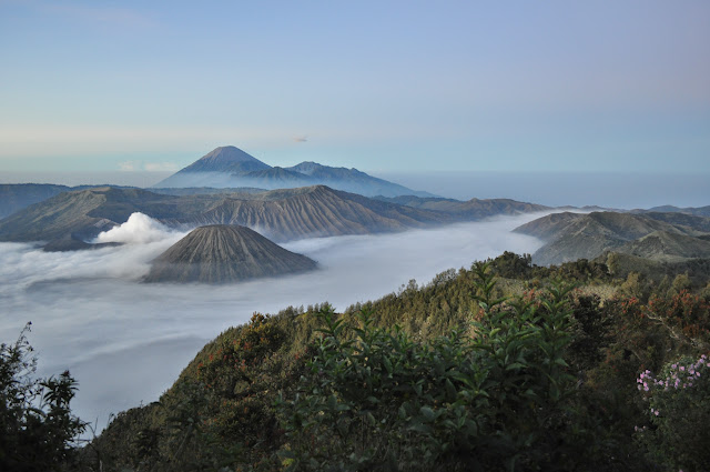
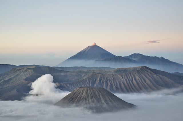
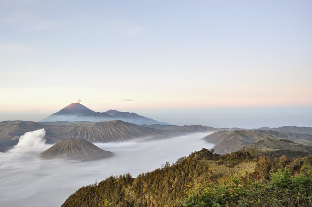
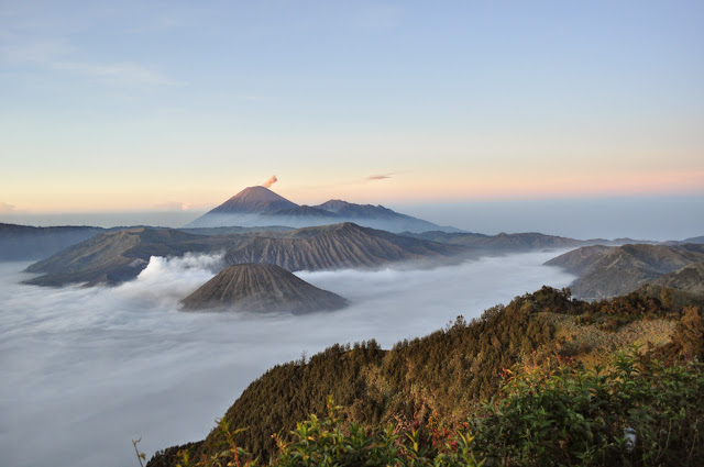
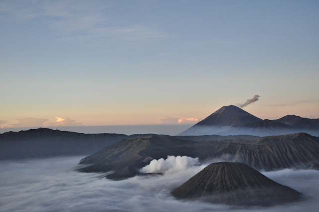
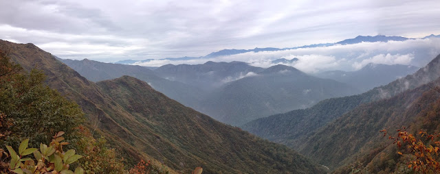
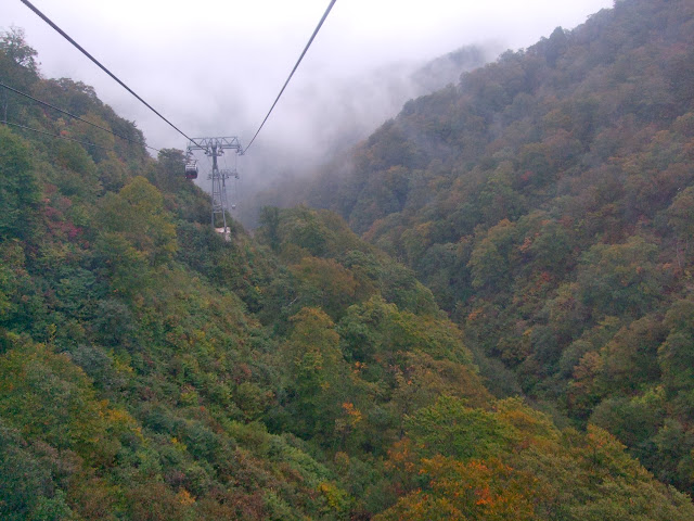
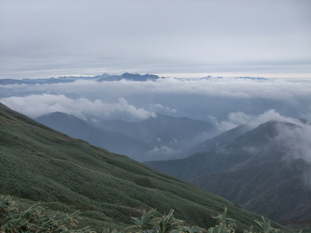
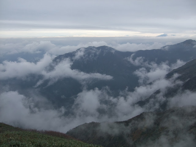
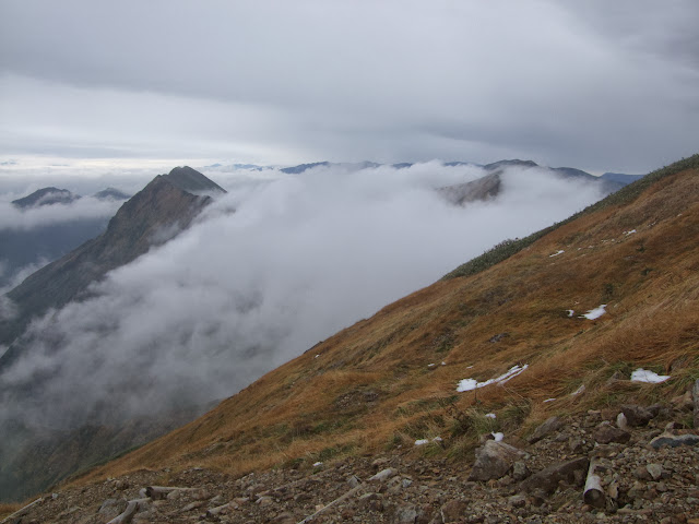
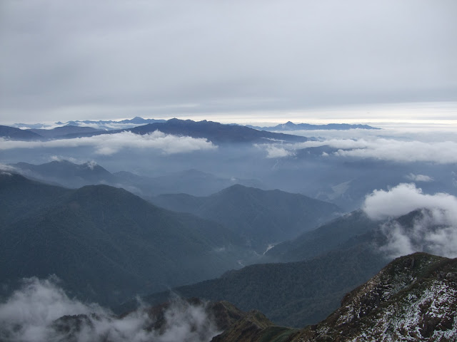
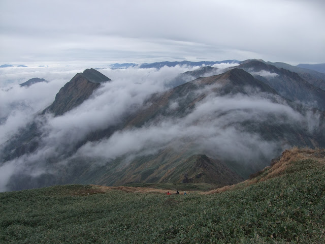
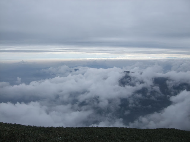
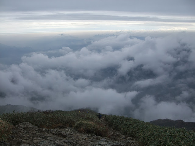
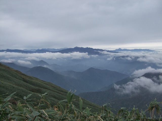
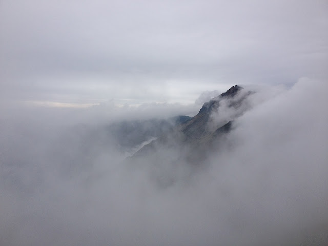
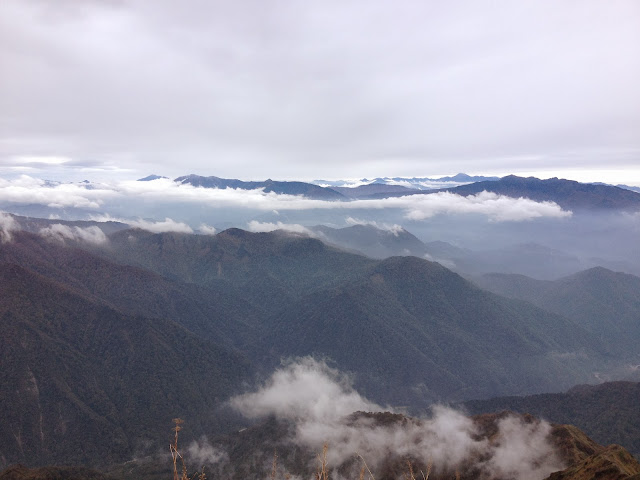
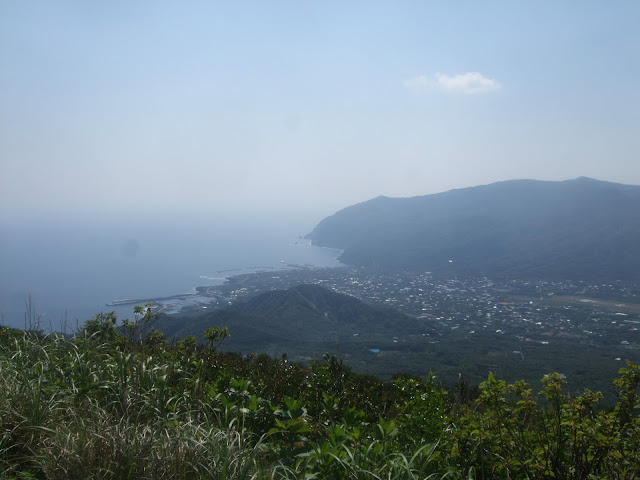
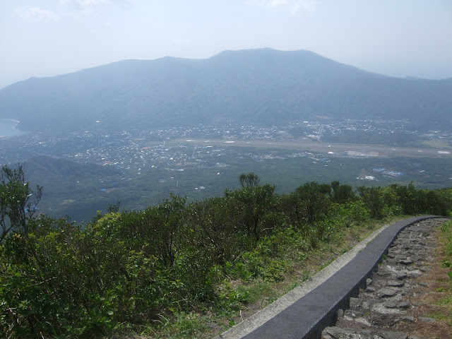
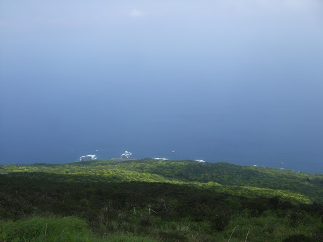
The clouds were constantly changing on this particularly day, providing varied backdrops to the scenery, all in a matter of hours:
<table style=”width:auto”><tr><td><a href=”https://picasaweb.google.com/lh/photo/Z8jQFpLGypOfneDSeJX9lQOVP5pgN1J-7jWX7d-iNUU?feat=embedwebsite”><img src=”https://lh4.googleusercontent.com/-_ccp074jX-Q/UoddU3YB7AI/AAAAAAACZaw/g7y7aLHWZP4/s640/DSC_0384.JPG” height=”425″ width=”640″ /></a></td></tr><tr><td style=”font-family:arial,sans-serif;font-size:11px;text-align:right”>From <a href=”https://picasaweb.google.com/116032719585350311356/OzeTrail?authuser=0&feat=embedwebsite”>Oze trail</a></td></tr></table>
<table style=”width:auto”><tr><td><a href=”https://picasaweb.google.com/lh/photo/TP9E5lZsuJnHbubq816a0wOVP5pgN1J-7jWX7d-iNUU?feat=embedwebsite”><img src=”https://lh5.googleusercontent.com/-e6LqGZPpxsU/UoddVW1EQoI/AAAAAAACZbA/ZzR1YmjqFEI/s640/DSC_0385.JPG” height=”425″ width=”640″ /></a></td></tr><tr><td style=”font-family:arial,sans-serif;font-size:11px;text-align:right”>From <a href=”https://picasaweb.google.com/116032719585350311356/OzeTrail?authuser=0&feat=embedwebsite”>Oze trail</a></td></tr></table>
<table style=”width:auto”><tr><td><a href=”https://picasaweb.google.com/lh/photo/4xDyvtmZUUohgOoExuGDCgOVP5pgN1J-7jWX7d-iNUU?feat=embedwebsite”><img src=”https://lh6.googleusercontent.com/-oYT5k1iS1Ak/UoddVtVcchI/AAAAAAACZbI/dHwgMTq3hDA/s640/DSC_0388.JPG” height=”425″ width=”640″ /></a></td></tr><tr><td style=”font-family:arial,sans-serif;font-size:11px;text-align:right”>From <a href=”https://picasaweb.google.com/116032719585350311356/OzeTrail?authuser=0&feat=embedwebsite”>Oze trail</a></td></tr></table>
<table style=”width:auto”><tr><td><a href=”https://picasaweb.google.com/lh/photo/-Qb1ATzatpwnk5-QH8U-JwOVP5pgN1J-7jWX7d-iNUU?feat=embedwebsite”><img src=”https://lh4.googleusercontent.com/-PXDpCzWiMhw/UoddV2S9iJI/AAAAAAACZbQ/mbxQJdjrgC8/s640/DSC_0390.JPG” height=”425″ width=”640″ /></a></td></tr><tr><td style=”font-family:arial,sans-serif;font-size:11px;text-align:right”>From <a href=”https://picasaweb.google.com/116032719585350311356/OzeTrail?authuser=0&feat=embedwebsite”>Oze trail</a></td></tr></table>
<table style=”width:auto”><tr><td><a href=”https://picasaweb.google.com/lh/photo/SYQcB1u05Y2vGnUAzZrQrwOVP5pgN1J-7jWX7d-iNUU?feat=embedwebsite”><img src=”https://lh4.googleusercontent.com/-0BKbwH5WXYo/UoddWmxG5CI/AAAAAAACZbM/GY1QDpDb3L0/s640/DSC_0393.JPG” height=”425″ width=”640″ /></a></td></tr><tr><td style=”font-family:arial,sans-serif;font-size:11px;text-align:right”>From <a href=”https://picasaweb.google.com/116032719585350311356/OzeTrail?authuser=0&feat=embedwebsite”>Oze trail</a></td></tr></table>
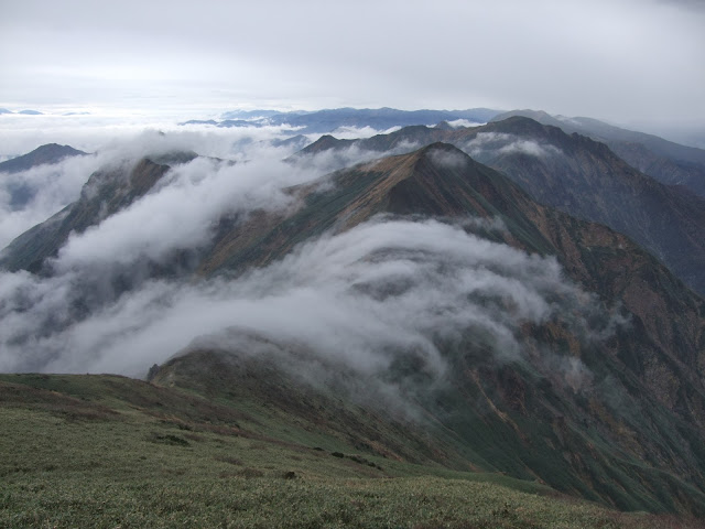
Yeah, that’s right. More photos.
<table style=”width:auto”><tr><td><a href=”https://picasaweb.google.com/lh/photo/vYg4Mky9HbCsC-AUqy5NPwOVP5pgN1J-7jWX7d-iNUU?feat=embedwebsite”><img src=”https://lh3.googleusercontent.com/-c4Kugcy1h18/UoddXAKv3KI/AAAAAAACZbo/aVLCamDMYNM/s640/DSC_0394.JPG” height=”425″ width=”640″ /></a></td></tr><tr><td style=”font-family:arial,sans-serif;font-size:11px;text-align:right”>From <a href=”https://picasaweb.google.com/116032719585350311356/OzeTrail?authuser=0&feat=embedwebsite”>Oze trail</a></td></tr></table>
<table style=”width:auto”><tr><td><a href=”https://picasaweb.google.com/lh/photo/yzX3xYBGBjrdmMcKGi9PFAOVP5pgN1J-7jWX7d-iNUU?feat=embedwebsite”><img src=”https://lh3.googleusercontent.com/-qY3KHyi4E-g/UoddXWh2y7I/AAAAAAACZbc/0lSmAkP8hp4/s640/DSC_0395.JPG” height=”425″ width=”640″ /></a></td></tr><tr><td style=”font-family:arial,sans-serif;font-size:11px;text-align:right”>From <a href=”https://picasaweb.google.com/116032719585350311356/OzeTrail?authuser=0&feat=embedwebsite”>Oze trail</a></td></tr></table>
<table style=”width:auto”><tr><td><a href=”https://picasaweb.google.com/lh/photo/xwUiNm1y7GV5pnkG_YTWBAOVP5pgN1J-7jWX7d-iNUU?feat=embedwebsite”><img src=”https://lh4.googleusercontent.com/-R-TqDSK4Gtg/UoddZbCL7-I/AAAAAAACZcA/fWLG8C-y-3Y/s640/DSC_0398.JPG” height=”425″ width=”640″ /></a></td></tr><tr><td style=”font-family:arial,sans-serif;font-size:11px;text-align:right”>From <a href=”https://picasaweb.google.com/116032719585350311356/OzeTrail?authuser=0&feat=embedwebsite”>Oze trail</a></td></tr></table>
<table style=”width:auto”><tr><td><a href=”https://picasaweb.google.com/lh/photo/pCLbmE0C639Cw9uxyqz5eAOVP5pgN1J-7jWX7d-iNUU?feat=embedwebsite”><img src=”https://lh6.googleusercontent.com/-d24nDdG4zbg/UoddaCT-hFI/AAAAAAACZcI/ZPhEx2qudAI/s640/DSC_0401.JPG” height=”425″ width=”640″ /></a></td></tr><tr><td style=”font-family:arial,sans-serif;font-size:11px;text-align:right”>From <a href=”https://picasaweb.google.com/116032719585350311356/OzeTrail?authuser=0&feat=embedwebsite”>Oze trail</a></td></tr></table>
When we stopped for lunch, we totally gatecrashed this guy’s napping spot, and he still didn’t budge!
<table style=”width:auto”><tr><td><a href=”https://picasaweb.google.com/lh/photo/ka_E2qp_eAdp_7rr9rJhvAOVP5pgN1J-7jWX7d-iNUU?feat=embedwebsite”><img src=”https://lh4.googleusercontent.com/-t0XggzDuRYw/UoddamKCNUI/AAAAAAACZcQ/Y9YTAjVsQfI/s640/DSC_0405.JPG” height=”425″ width=”640″ /></a></td></tr><tr><td style=”font-family:arial,sans-serif;font-size:11px;text-align:right”>From <a href=”https://picasaweb.google.com/116032719585350311356/OzeTrail?authuser=0&feat=embedwebsite”>Oze trail</a></td></tr></table>
<table style=”width:auto”><tr><td><a href=”https://picasaweb.google.com/lh/photo/57-HkRjcIczXKoYsE6bzqgOVP5pgN1J-7jWX7d-iNUU?feat=embedwebsite”><img src=”https://lh4.googleusercontent.com/-dVFlkH7hy8o/Uoddaniul5I/AAAAAAACfMo/NPrhtghCNZo/s640/DSC_0404.JPG” height=”562″ width=”640″ /></a></td></tr><tr><td style=”font-family:arial,sans-serif;font-size:11px;text-align:right”>From <a href=”https://picasaweb.google.com/116032719585350311356/OzeTrail?authuser=0&feat=embedwebsite”>Oze trail</a></td></tr></table>
<table style=”width:auto”><tr><td><a href=”https://picasaweb.google.com/lh/photo/AtHcbK5HJJ2AUKZ6HjIBFgOVP5pgN1J-7jWX7d-iNUU?feat=embedwebsite”><img src=”https://lh6.googleusercontent.com/-8JrtmsoBvpk/UoddcKUuk5I/AAAAAAACZc4/ISWTuy2EAJw/s640/DSC_0409.JPG” height=”425″ width=”640″ /></a></td></tr><tr><td style=”font-family:arial,sans-serif;font-size:11px;text-align:right”>From <a href=”https://picasaweb.google.com/116032719585350311356/OzeTrail?authuser=0&feat=embedwebsite”>Oze trail</a></td></tr></table>
<table style=”width:auto”><tr><td><a href=”https://picasaweb.google.com/lh/photo/8qSXcK0vtdFIX6DCgTCZrgOVP5pgN1J-7jWX7d-iNUU?feat=embedwebsite”><img src=”https://lh4.googleusercontent.com/-9eVHIJtVjUA/Uoddc69l-tI/AAAAAAACZc8/lOsW7VhVQ4s/s640/DSC_0413.JPG” height=”425″ width=”640″ /></a></td></tr><tr><td style=”font-family:arial,sans-serif;font-size:11px;text-align:right”>From <a href=”https://picasaweb.google.com/116032719585350311356/OzeTrail?authuser=0&feat=embedwebsite”>Oze trail</a></td></tr></table>
<table style=”width:auto”><tr><td><a href=”https://picasaweb.google.com/lh/photo/K1ZawzZUNmybbUso1IoBJQOVP5pgN1J-7jWX7d-iNUU?feat=embedwebsite”><img src=”https://lh5.googleusercontent.com/-5dFezQoKebE/UodddU-wVoI/AAAAAAACZdQ/qof5PzNnkzo/s640/DSC_0414.JPG” height=”425″ width=”640″ /></a></td></tr><tr><td style=”font-family:arial,sans-serif;font-size:11px;text-align:right”>From <a href=”https://picasaweb.google.com/116032719585350311356/OzeTrail?authuser=0&feat=embedwebsite”>Oze trail</a></td></tr></table>
<table style=”width:auto”><tr><td><a href=”https://picasaweb.google.com/lh/photo/2QbmibXhyVaNmt_dEFbeCwOVP5pgN1J-7jWX7d-iNUU?feat=embedwebsite”><img src=”https://lh6.googleusercontent.com/-kbfeAfWqc24/Uoddeo_QyhI/AAAAAAACZdg/vBMEedBlmII/s640/DSC_0421.JPG” height=”425″ width=”640″ /></a></td></tr><tr><td style=”font-family:arial,sans-serif;font-size:11px;text-align:right”>From <a href=”https://picasaweb.google.com/116032719585350311356/OzeTrail?authuser=0&feat=embedwebsite”>Oze trail</a></td></tr></table>
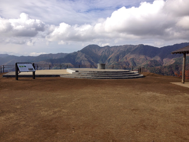
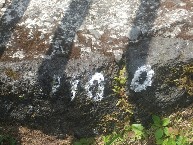
Halfway:
<table style=”width:auto”><tr><td><a href=”https://picasaweb.google.com/lh/photo/Q0HTx-zULBSOUY-ItIbRggOVP5pgN1J-7jWX7d-iNUU?feat=embedwebsite”><img src=”https://lh3.googleusercontent.com/-tV9fp-5KL4M/Uoddhgm1s6I/AAAAAAACZeQ/_g3TwJzs_ic/s640/DSC_0426.JPG” height=”425″ width=”640″ /></a></td></tr><tr><td style=”font-family:arial,sans-serif;font-size:11px;text-align:right”>From <a href=”https://picasaweb.google.com/116032719585350311356/OzeTrail?authuser=0&feat=embedwebsite”>Oze trail</a></td></tr></table>
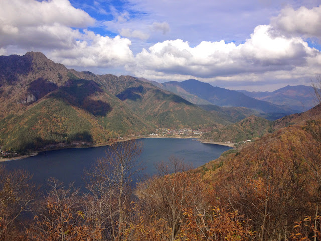
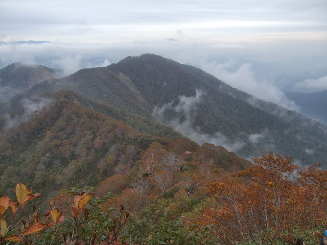
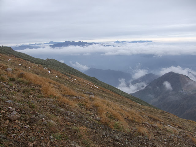
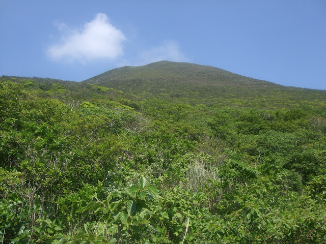
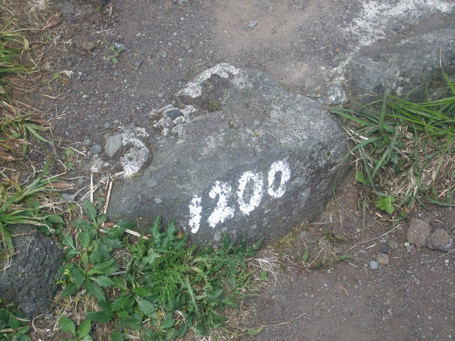
In the “middle” of nowhere:
<table style=”width:auto”><tr><td><a href=”https://picasaweb.google.com/lh/photo/Cv4QQSHYHGfNA-ktn1IlowOVP5pgN1J-7jWX7d-iNUU?feat=embedwebsite”><img src=”https://lh3.googleusercontent.com/-DOY9KAMnc5c/Uoddg7N0StI/AAAAAAACZeU/ocx7HmfZTpg/s640/DSC_0427.JPG” height=”425″ width=”640″ /></a></td></tr><tr><td style=”font-family:arial,sans-serif;font-size:11px;text-align:right”>From <a href=”https://picasaweb.google.com/116032719585350311356/OzeTrail?authuser=0&feat=embedwebsite”>Oze trail</a></td></tr></table>
<table style=”width:auto”><tr><td><a href=”https://picasaweb.google.com/lh/photo/AtCTOH8V1kwrsArH-v8W6QOVP5pgN1J-7jWX7d-iNUU?feat=embedwebsite”><img src=”https://lh4.googleusercontent.com/-SzL28SHDo7o/UoddjIyEXlI/AAAAAAACZew/jh-Bm9xumb4/s640/DSC_0436.JPG” height=”425″ width=”640″ /></a></td></tr><tr><td style=”font-family:arial,sans-serif;font-size:11px;text-align:right”>From <a href=”https://picasaweb.google.com/116032719585350311356/OzeTrail?authuser=0&feat=embedwebsite”>Oze trail</a></td></tr></table>
<table style=”width:auto”><tr><td><a href=”https://picasaweb.google.com/lh/photo/6Rw3oyq8c1wjmoOG3-QvjQOVP5pgN1J-7jWX7d-iNUU?feat=embedwebsite”><img src=”https://lh6.googleusercontent.com/-lIcZl-Iy18w/UoddjUwhiwI/AAAAAAACZe4/kOOMCdgWfFw/s640/DSC_0437.JPG” height=”425″ width=”640″ /></a></td></tr><tr><td style=”font-family:arial,sans-serif;font-size:11px;text-align:right”>From <a href=”https://picasaweb.google.com/116032719585350311356/OzeTrail?authuser=0&feat=embedwebsite”>Oze trail</a></td></tr></table>
<table style=”width:auto”><tr><td><a href=”https://picasaweb.google.com/lh/photo/zHhjE9hOJBxOrvY-0zGDAQOVP5pgN1J-7jWX7d-iNUU?feat=embedwebsite”><img src=”https://lh6.googleusercontent.com/-tGaA9W7elFc/UoddngOQGbI/AAAAAAACZgQ/W2necn-H0wk/s640/DSC_0457.jpg” height=”640″ width=”425″ /></a></td></tr><tr><td style=”font-family:arial,sans-serif;font-size:11px;text-align:right”>From <a href=”https://picasaweb.google.com/116032719585350311356/OzeTrail?authuser=0&feat=embedwebsite”>Oze trail</a></td></tr></table>
<table style=”width:auto”><tr><td><a href=”https://picasaweb.google.com/lh/photo/RhPhCNyGaiBmnurqvH1rIAOVP5pgN1J-7jWX7d-iNUU?feat=embedwebsite”><img src=”https://lh3.googleusercontent.com/-tdmFfVLE6ys/UoddoupBilI/AAAAAAACZgg/qrkolKVOik4/s640/DSC_0462.JPG” height=”425″ width=”640″ /></a></td></tr><tr><td style=”font-family:arial,sans-serif;font-size:11px;text-align:right”>From <a href=”https://picasaweb.google.com/116032719585350311356/OzeTrail?authuser=0&feat=embedwebsite”>Oze trail</a></td></tr></table>
<table style=”width:auto”><tr><td><a href=”https://picasaweb.google.com/lh/photo/FG-m–2PteHK3c9k1oS2awOVP5pgN1J-7jWX7d-iNUU?feat=embedwebsite”><img src=”https://lh5.googleusercontent.com/-K8ogrVl5CBI/Uoddo3Iql7I/AAAAAAACZgk/yVvY7Hez-mM/s640/DSC_0463.JPG” height=”425″ width=”640″ /></a></td></tr><tr><td style=”font-family:arial,sans-serif;font-size:11px;text-align:right”>From <a href=”https://picasaweb.google.com/116032719585350311356/OzeTrail?authuser=0&feat=embedwebsite”>Oze trail</a></td></tr></table>
<table style=”width:auto”><tr><td><a href=”https://picasaweb.google.com/lh/photo/lWRejvsd0UWvCMTz0zz5RwOVP5pgN1J-7jWX7d-iNUU?feat=embedwebsite”><img src=”https://lh6.googleusercontent.com/-Z1AlTfItUAQ/Uoddp9WnAyI/AAAAAAACZg4/ANBTWHgnd6M/s640/DSC_0466.JPG” height=”425″ width=”640″ /></a></td></tr><tr><td style=”font-family:arial,sans-serif;font-size:11px;text-align:right”>From <a href=”https://picasaweb.google.com/116032719585350311356/OzeTrail?authuser=0&feat=embedwebsite”>Oze trail</a></td></tr></table>
<table style=”width:auto”><tr><td><a href=”https://picasaweb.google.com/lh/photo/zjjCtceWofijroPxZThjcQOVP5pgN1J-7jWX7d-iNUU?feat=embedwebsite”><img src=”https://lh5.googleusercontent.com/-vhTcXya3h_k/Uoddrh-T9-I/AAAAAAACZhg/5FjYvqa1Fpw/s640/DSC_0473.JPG” height=”425″ width=”640″ /></a></td></tr><tr><td style=”font-family:arial,sans-serif;font-size:11px;text-align:right”>From <a href=”https://picasaweb.google.com/116032719585350311356/OzeTrail?authuser=0&feat=embedwebsite”>Oze trail</a></td></tr></table>
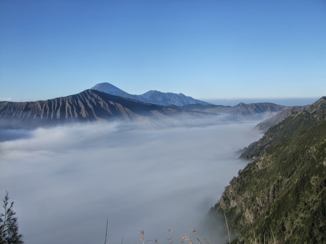
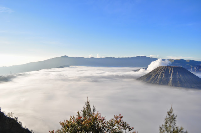
And because I haven’t posted enough photos….here are a few more.
<table style=”width:auto”><tr><td><a href=”https://picasaweb.google.com/lh/photo/daoh9o7WzeKpnBDHHx1tJQOVP5pgN1J-7jWX7d-iNUU?feat=embedwebsite”><img src=”https://lh6.googleusercontent.com/-kz_3vqEGkqo/UoddtXpRUPI/AAAAAAACZiE/g23_yx0C8zY/s640/DSC_0479.jpg” height=”640″ width=”425″ /></a></td></tr><tr><td style=”font-family:arial,sans-serif;font-size:11px;text-align:right”>From <a href=”https://picasaweb.google.com/116032719585350311356/OzeTrail?authuser=0&feat=embedwebsite”>Oze trail</a></td></tr></table>
<table style=”width:auto”><tr><td><a href=”https://picasaweb.google.com/lh/photo/k_KuV40vPlQqa70NesjAzQOVP5pgN1J-7jWX7d-iNUU?feat=embedwebsite”><img src=”https://lh3.googleusercontent.com/-UDTP8WSK5gs/Uoddu5ho2qI/AAAAAAACZiU/pULXd73iaXQ/s640/DSC_0483.JPG” height=”425″ width=”640″ /></a></td></tr><tr><td style=”font-family:arial,sans-serif;font-size:11px;text-align:right”>From <a href=”https://picasaweb.google.com/116032719585350311356/OzeTrail?authuser=0&feat=embedwebsite”>Oze trail</a></td></tr></table>
<table style=”width:auto”><tr><td><a href=”https://picasaweb.google.com/lh/photo/I3JGV8c1p5gREIli6qidHwOVP5pgN1J-7jWX7d-iNUU?feat=embedwebsite”><img src=”https://lh5.googleusercontent.com/-L9QYPeWyeyM/Uodd3Gxl0TI/AAAAAAACZk0/UP5SbLHyC28/s640/DSC_0508.JPG” height=”425″ width=”640″ /></a></td></tr><tr><td style=”font-family:arial,sans-serif;font-size:11px;text-align:right”>From <a href=”https://picasaweb.google.com/116032719585350311356/OzeTrail?authuser=0&feat=embedwebsite”>Oze trail</a></td></tr></table>
<table style=”width:auto”><tr><td><a href=”https://picasaweb.google.com/lh/photo/JMClO01-A3-8rffCDHkF9wOVP5pgN1J-7jWX7d-iNUU?feat=embedwebsite”><img src=”https://lh5.googleusercontent.com/-IRVXkeGLcOY/Uodd98nm0CI/AAAAAAACZnA/xcREUrpNZ-s/s400/IMG_5465.JPG” height=”400″ width=”400″ /></a></td></tr><tr><td style=”font-family:arial,sans-serif;font-size:11px;text-align:right”>From <a href=”https://picasaweb.google.com/116032719585350311356/OzeTrail?authuser=0&feat=embedwebsite”>Oze trail</a></td></tr></table>


